
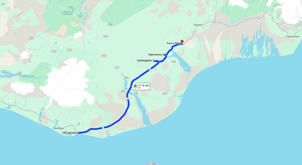
Route of Day 3
🚗 92km & 1h15
The first thing to comment is that this day is somewhat “lighter” in content.
Logistics did not allow us to find where to sleep closer to Skaftafell, where our Day 4 would start. Therefore, we were left to explore the area where we had our accommodation.
But as they say, every cloud has a silver lining. That day we had a very bad weather and it was even good for us to be able to take shelter earlier, without missing interesting places or doing them in bad conditions.
Below you would find all the details of the most important and recommended points of interest in this area. Although it can also be complemented with more sites or activities that you will see at the end.
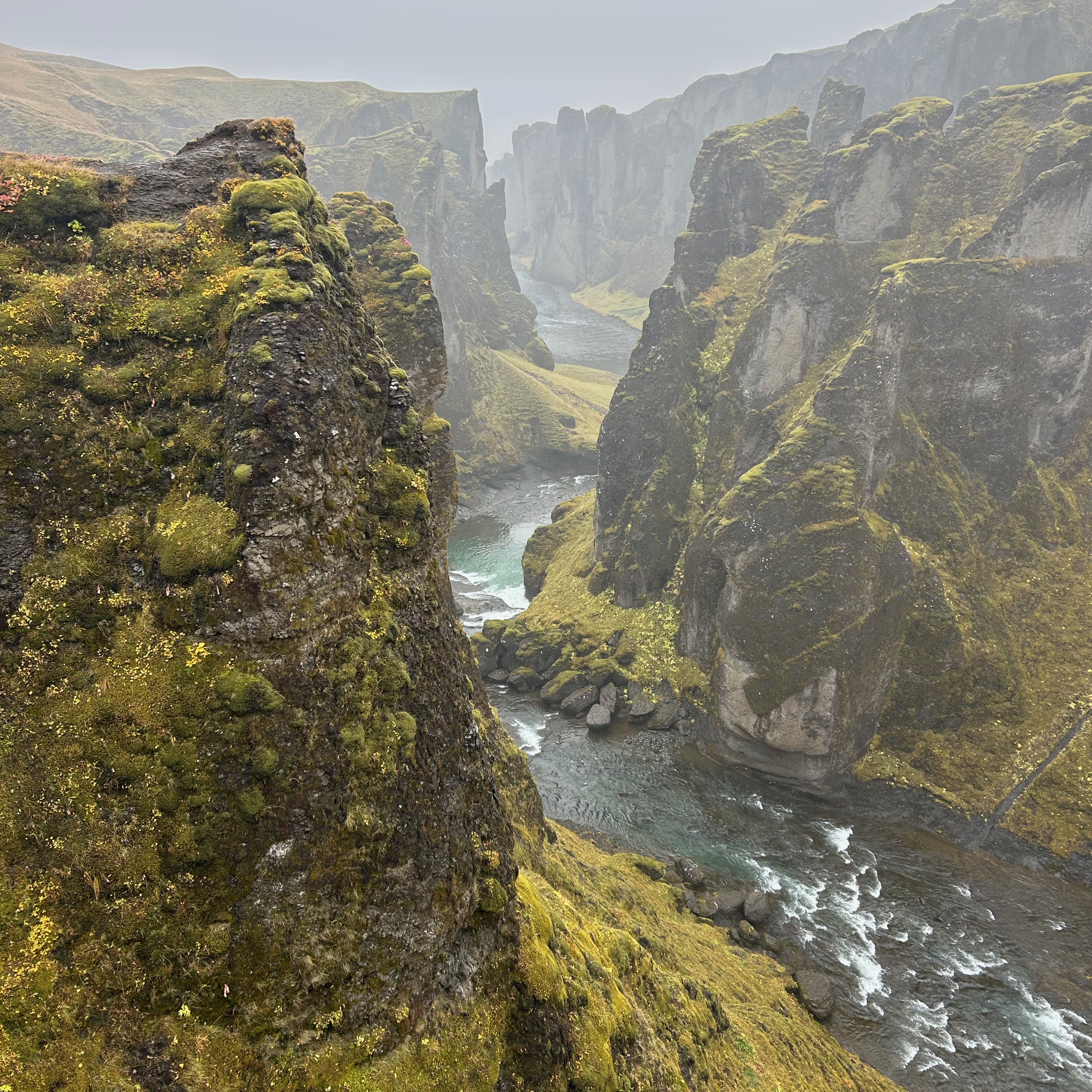
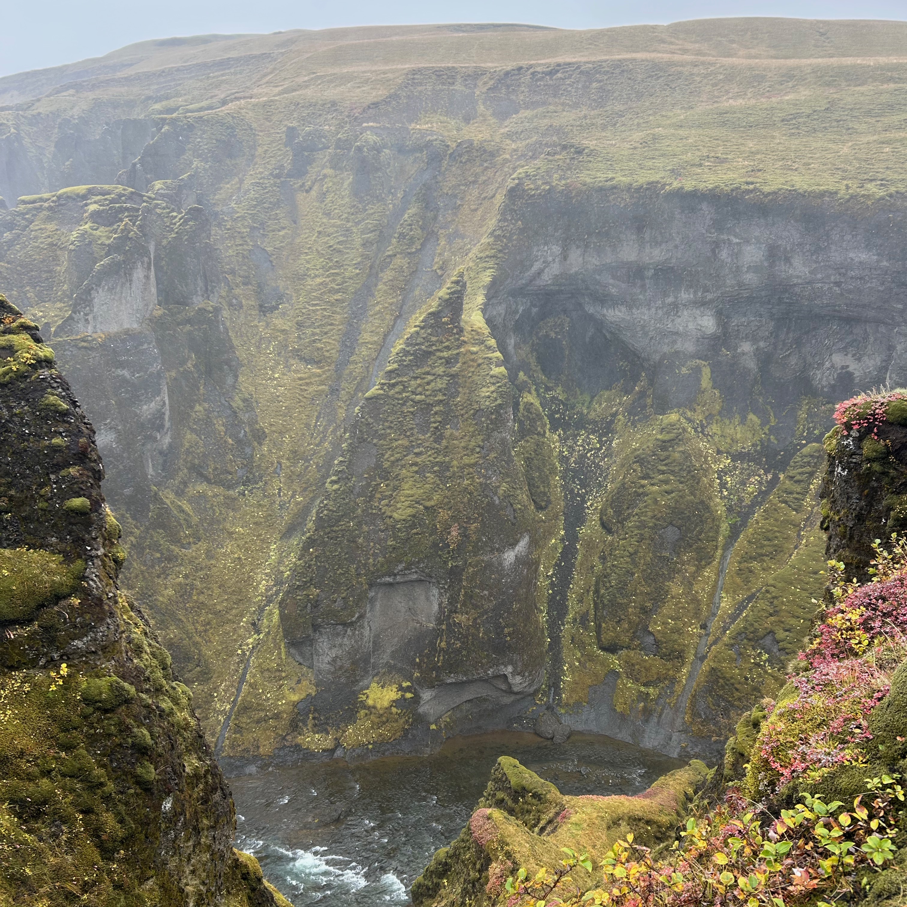
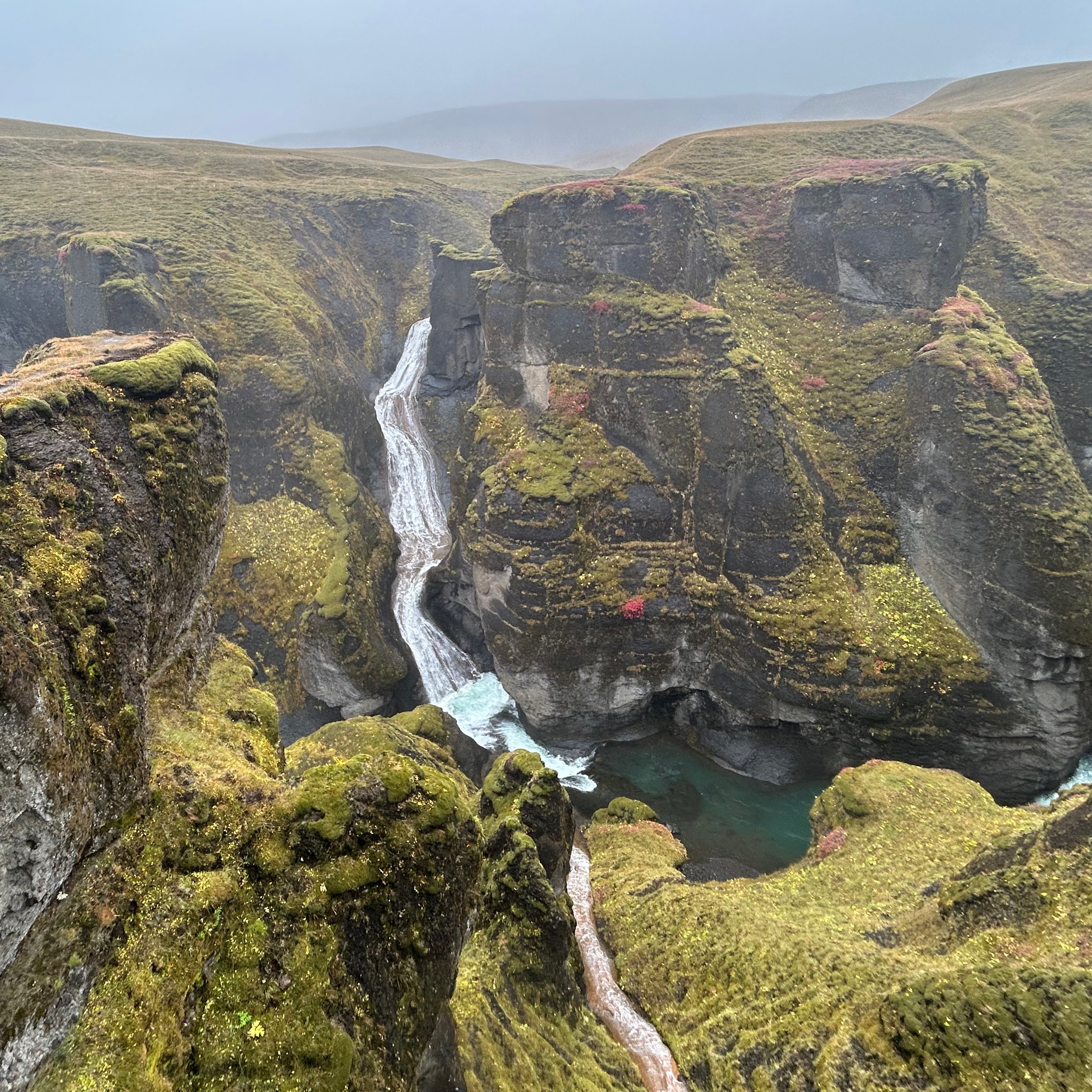
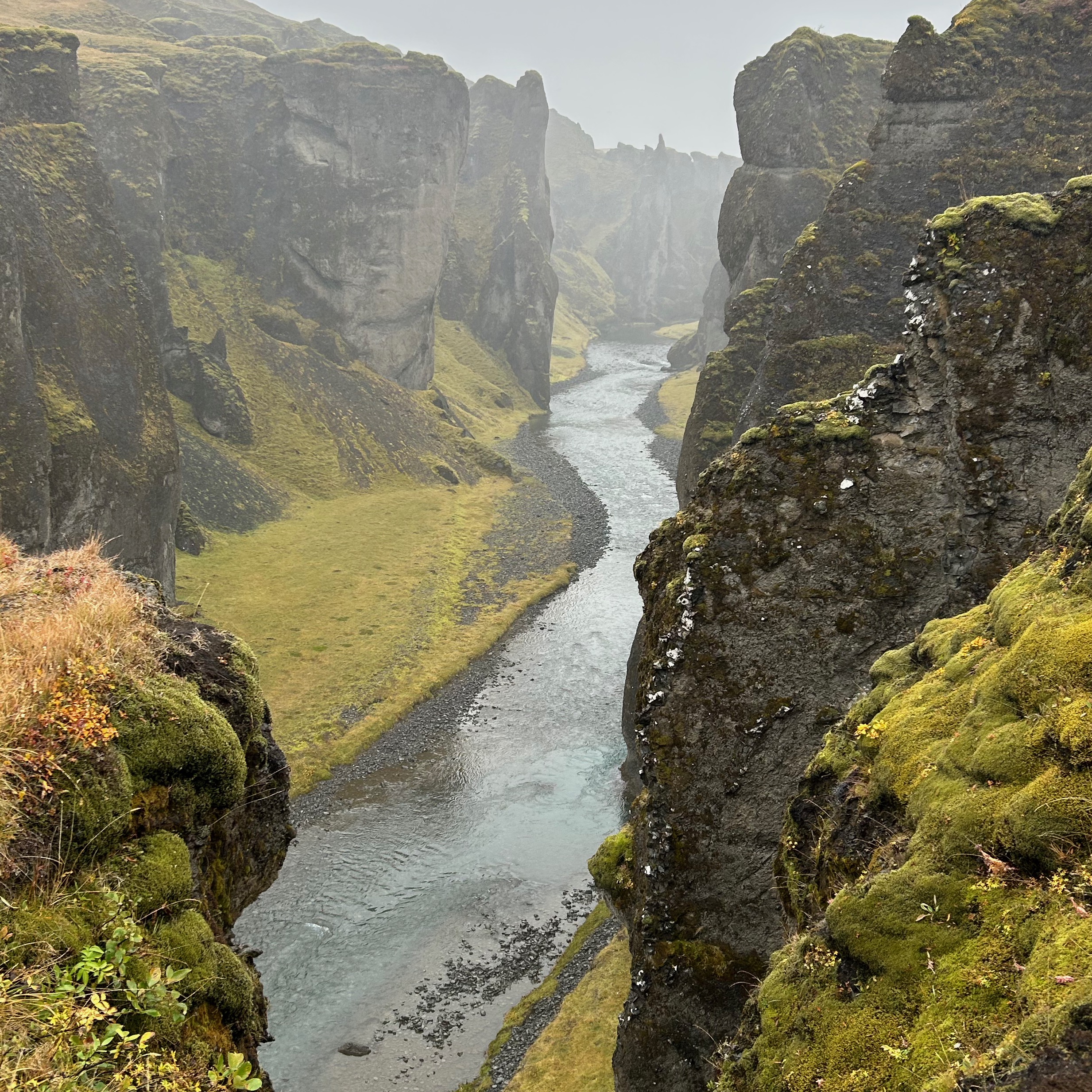
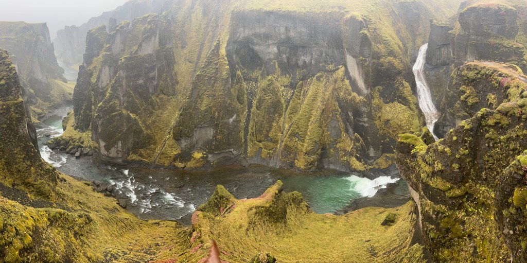
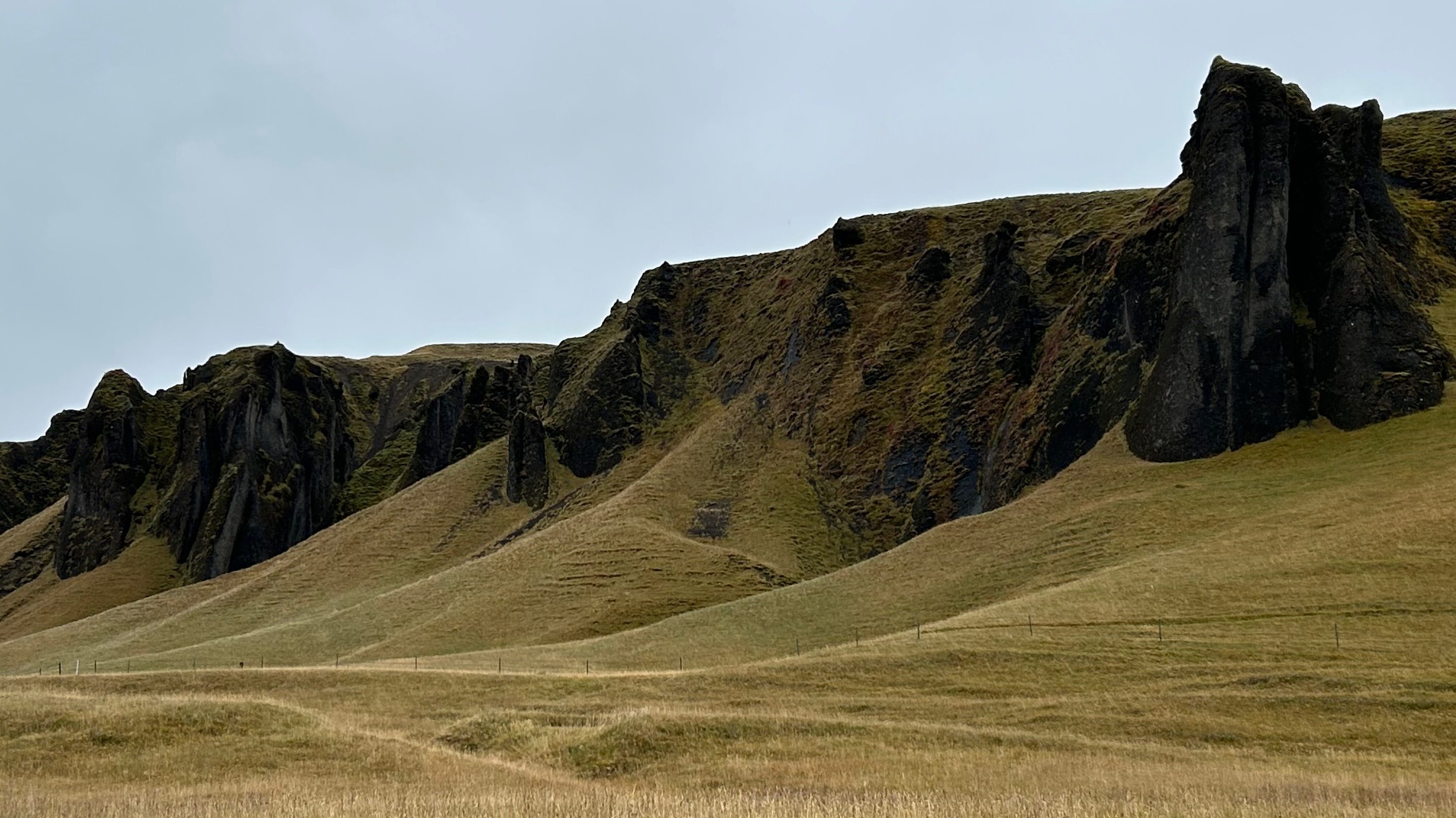
Fjaðrárgljúfur canyon ⭐️
The Fjaðrárgljúfur canyon is 100m deep and about 1km long. It is believed to have formed during the Ice Age, after the glacier slowly retreated and formed a lagoon. This stream began to slowly excavate the landscape creating the canyon 2 million years ago.
ℹ️ Useful informationl
🅿️ 1.000 ISK with App Parka
🚾 free
🚗 52min from Vik
⏳ 1h30 -> The route takes about 45min and the rest of the time to take pictures and the queue to get to the end of the walkway of the viewpoint.
💡 Tips:
- At the beginning of the trail there is a map a little ambiguous, as it seems that there are 2 parts: first 3km and then another 6km.
Therefore, it seems that it is 9km out and 9km back, but it is not so.
If you go all the way to the 360º viewpoint, the route is 3km in total, counting the round trip.

- Although the trail is easy to walk, good shoes and a raincoat are recommended for rainy days, as the trail becomes a muddy mess.
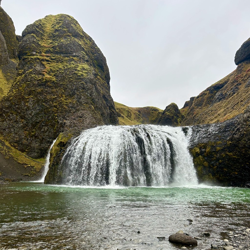
Stjórnarfoss ♦️
The Stjórnarfoss waterfall is a waterfall that may not be surprising, as it will not be the highest nor the one that carries more water. It is a small waterfall, but still has its charm.
ℹ️ Useful information
🚗 12min from Fjaðrárgljúfur canyon
⏳ 15min
Foss á Síðu️
The Foss á Síðu waterfall falls along the wall along the road. Although there is a space to stop, you will not be able to get close, as it is in a private area and there is a fence that limits the entrance.
Still it is beautiful to contemplate with the contrast of colors: the white water, the yellowish green vegetation and the gray and black stone.
ℹ️ Useful information
🅿️ free
🚗 14min from Stjórnarfoss
⏳ 5min

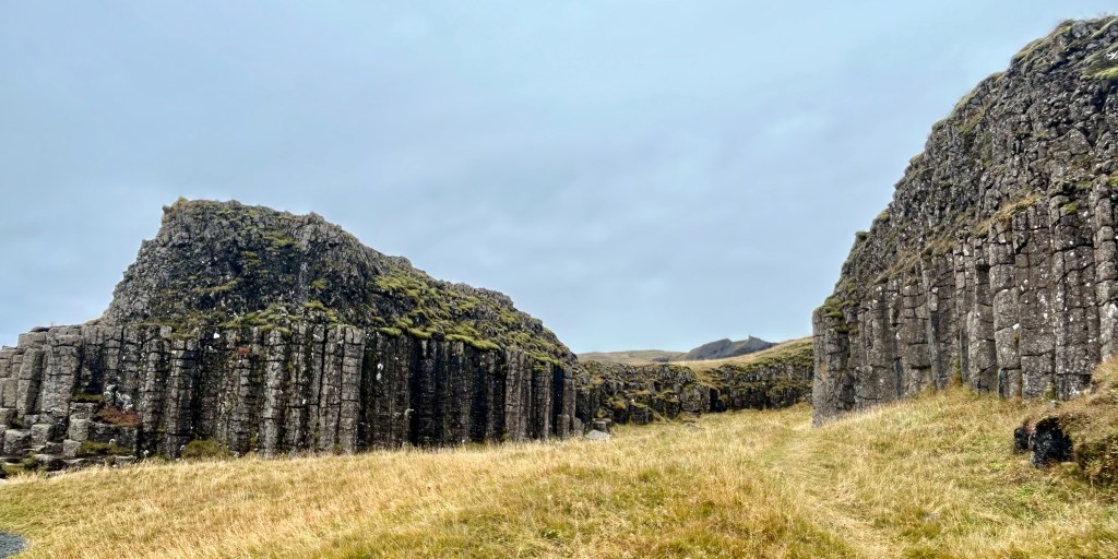
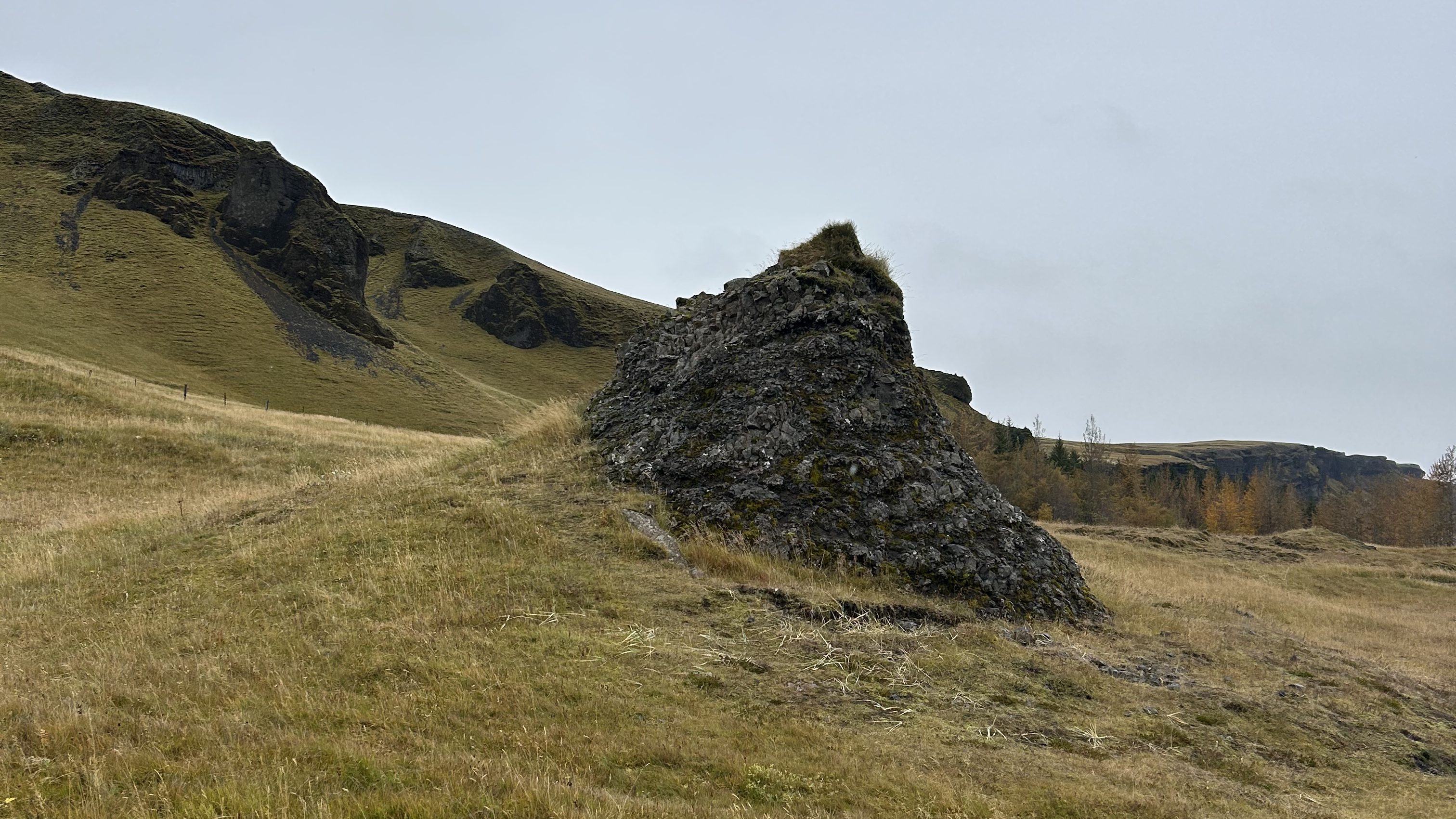
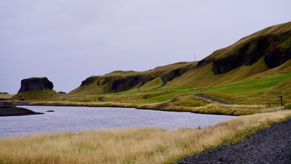
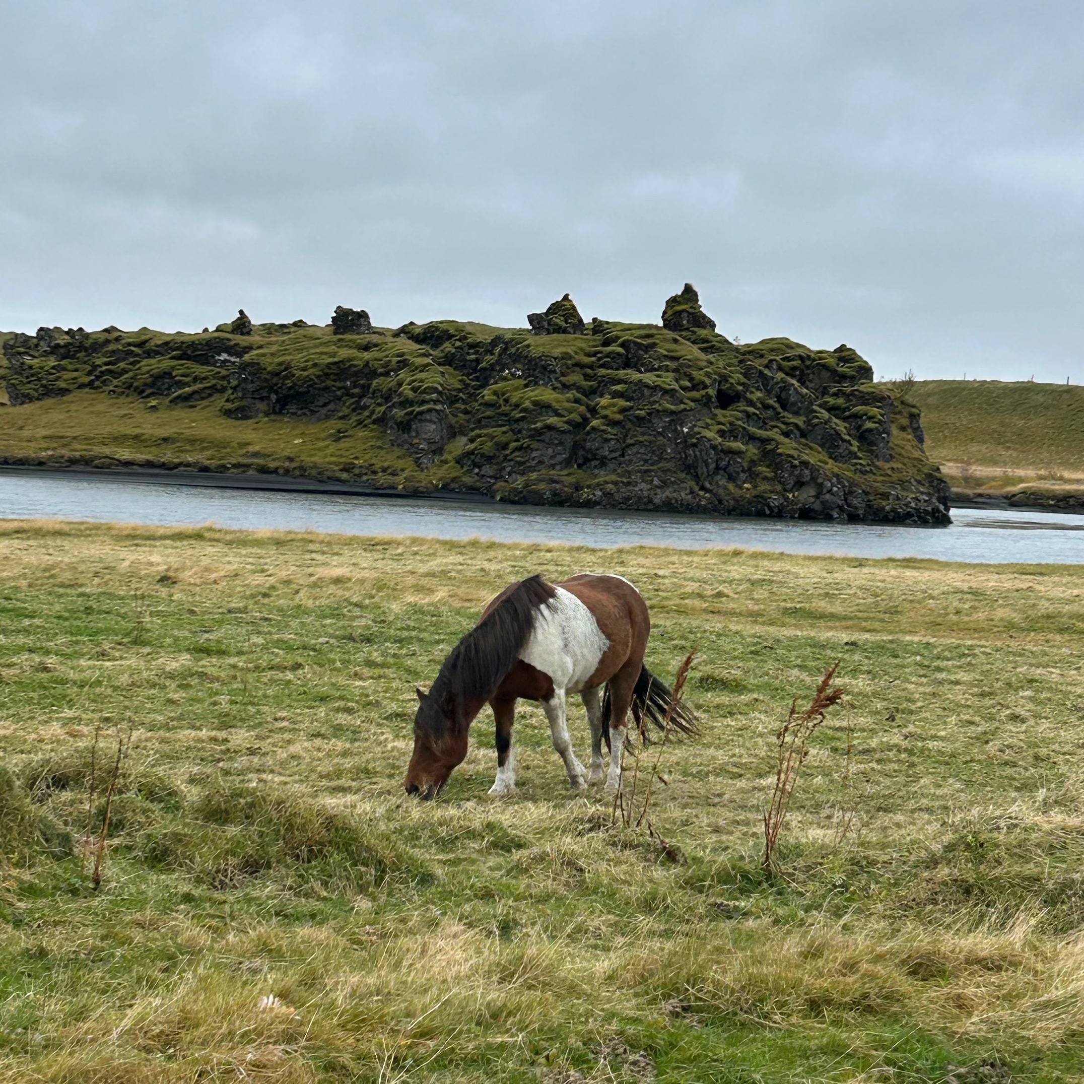
Dverghamrar ♦️
Dverghamrar, which means “dwarf cliff”, is a set of basalt columns. You can walk around the 2 mounds and contemplate the columns with more tranquility than in Reynisfjara beach.
ℹ️ Información útil
🅿️ free
🚗 2min from Foss á Síðu
⏳ 30min
Kirkjubæjarklaustur️
El pueblo Kirkjubæjarklaustur️, que significa iglesia (kirkju), granja (bæjar) y convento (klaustur️), también llamado solo Klaustur por los locales, mucho más fácil de pronunciar.
The village Kirkjubæjarklaustur️ means church (kirkju), farm (bæjar) and convent (klaustur️). Also just called Klaustur by locals, as it is much easier to pronounce.
ℹ️ Useful information
🚗 13min from Dverghamrar
⏳ 30min
💡 Tips: The village and the following points of interest is not a must on the tour of Iceland. In our case, we visited this town because it was conveniently located on the route and because we would spend the night here. So, we did not want to go further east and then have to return back.
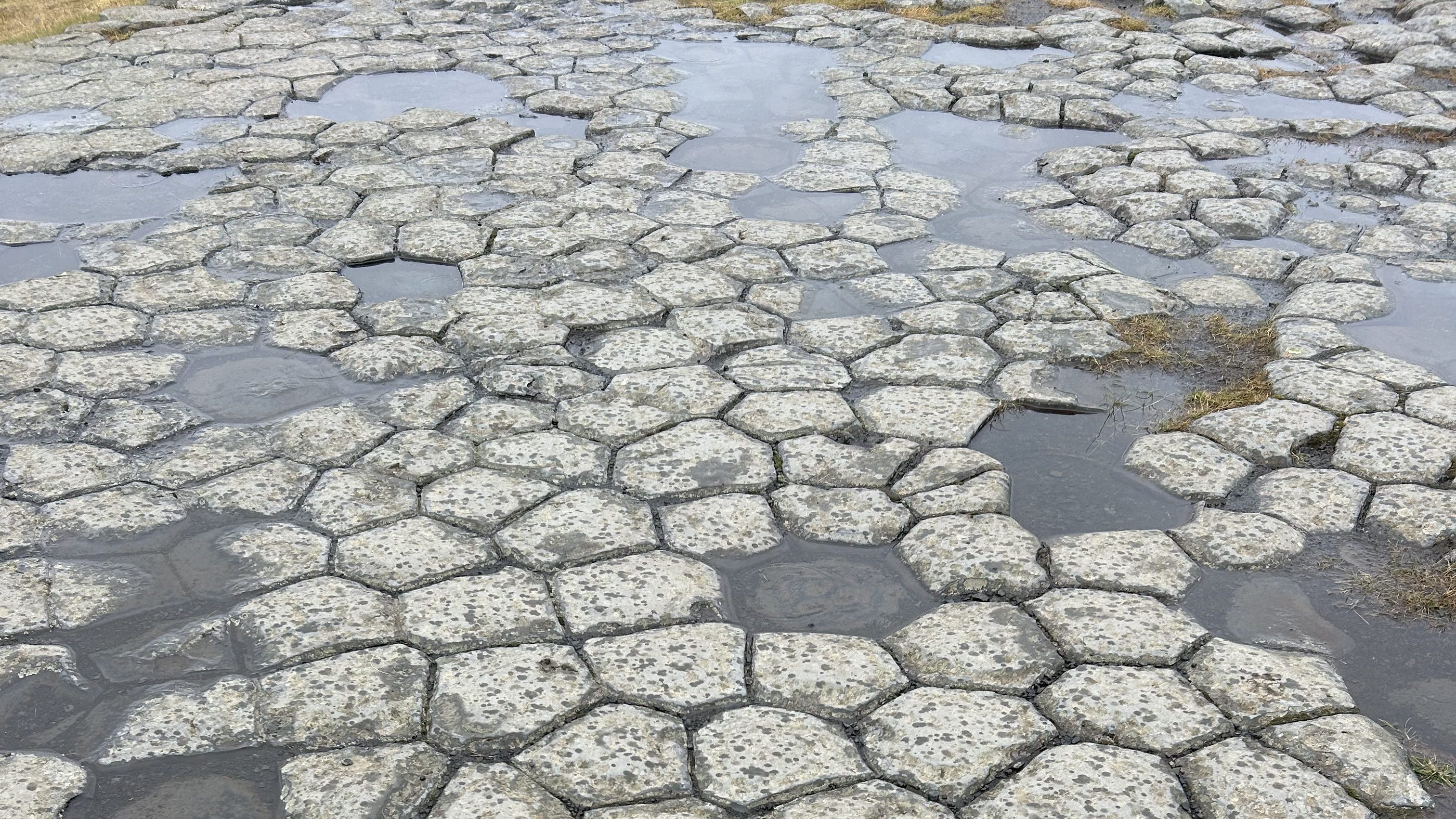
- Kirkjugólf Natural Monument
Kirkjugólf (“church floor”) is a rock formation from 9 million years ago, where you can see 80m2 of the top of the basalt columns that formed the ancient floor of a church.
The columns are always perpendicular to the surface. Because they are created vertically to the lava flow and when it cools, it cracks into these hexagonal columns. Although there are variations in the number of sides.
- Hildishaugur Burial Mound
The first inhabitants of Kirkjubar were Irish hermits and it is said that pagans were forbidden to live there. The Christian settler Ketill lived all his life in Kirkjubar, but when the pagan Hildir Eysteinsson planned to move there, he dropped dead as soon as he set foot on the estate and is buried in Hildishaugur.
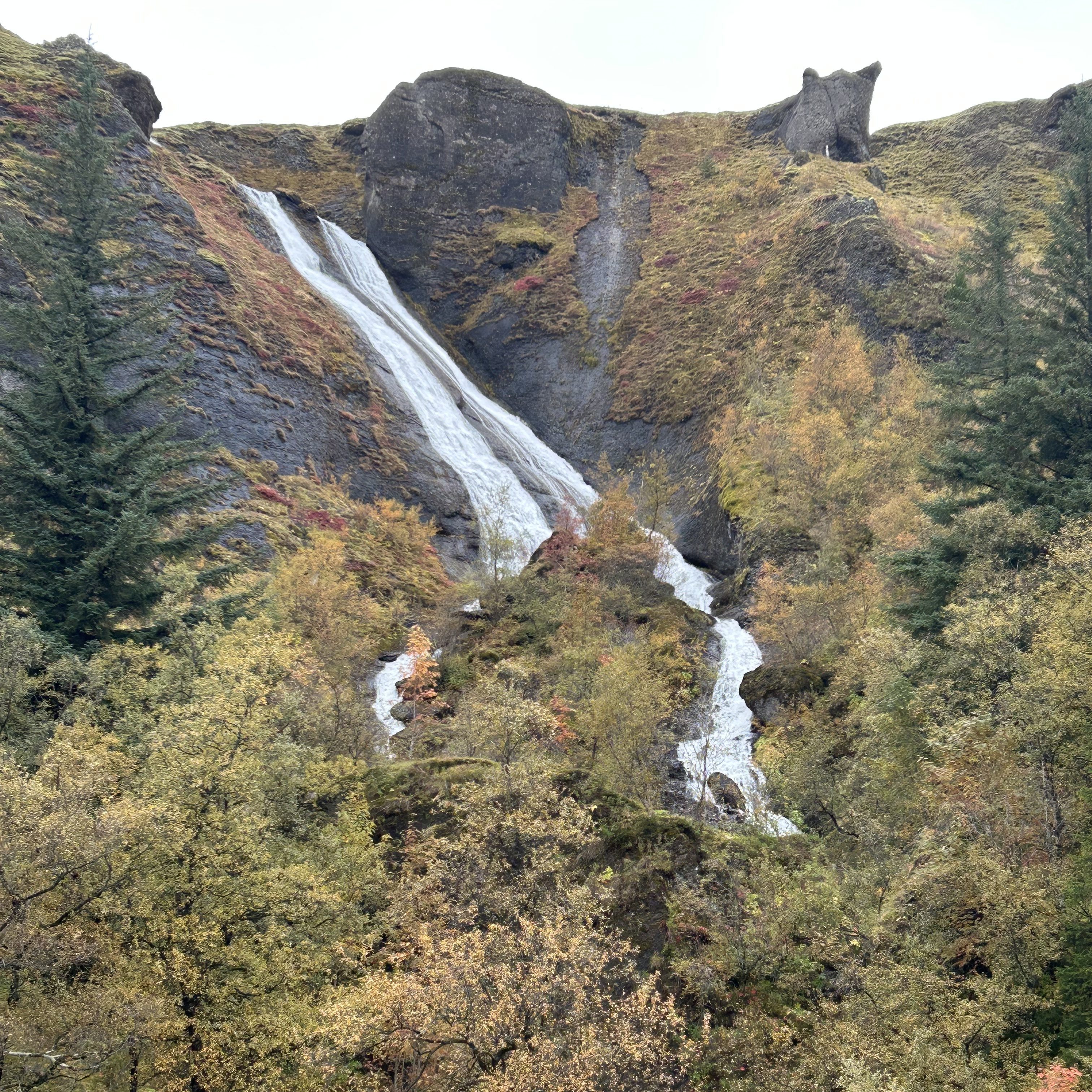
- Systrafoss
A double waterfall that you can admire from the various viewpoints and make a tour into the mountain. One of these trails leads to Systravatn Lake.
- Systratapi
A rock formation that supposedly marks the place where two nuns were executed after having slept with the devil.
You can walk along the edge of the river to get there. Although we could not get there, as a farmer prevented us from passing because she had to put cattle through.

What else to see?
Honestly, there is little more to see in this area.
If you run out of time, the best thing to do is to keep moving east and get closer to Skaftafell, which is the next starting point.
Where to eat?
As mentioned in the previous days, we recommend a hearty breakfast, a picnic lunch and an early dinner.
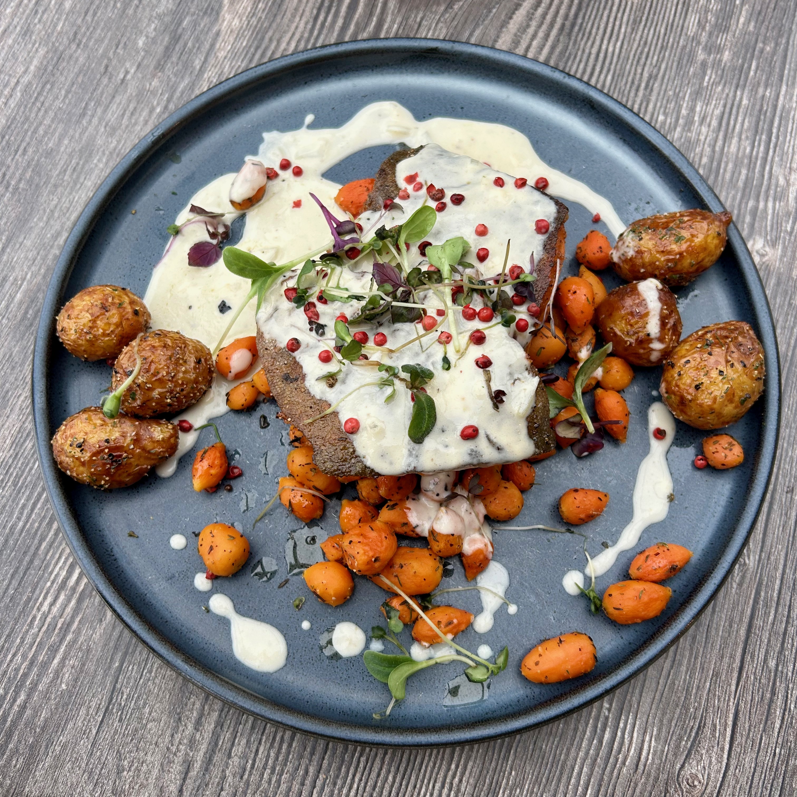
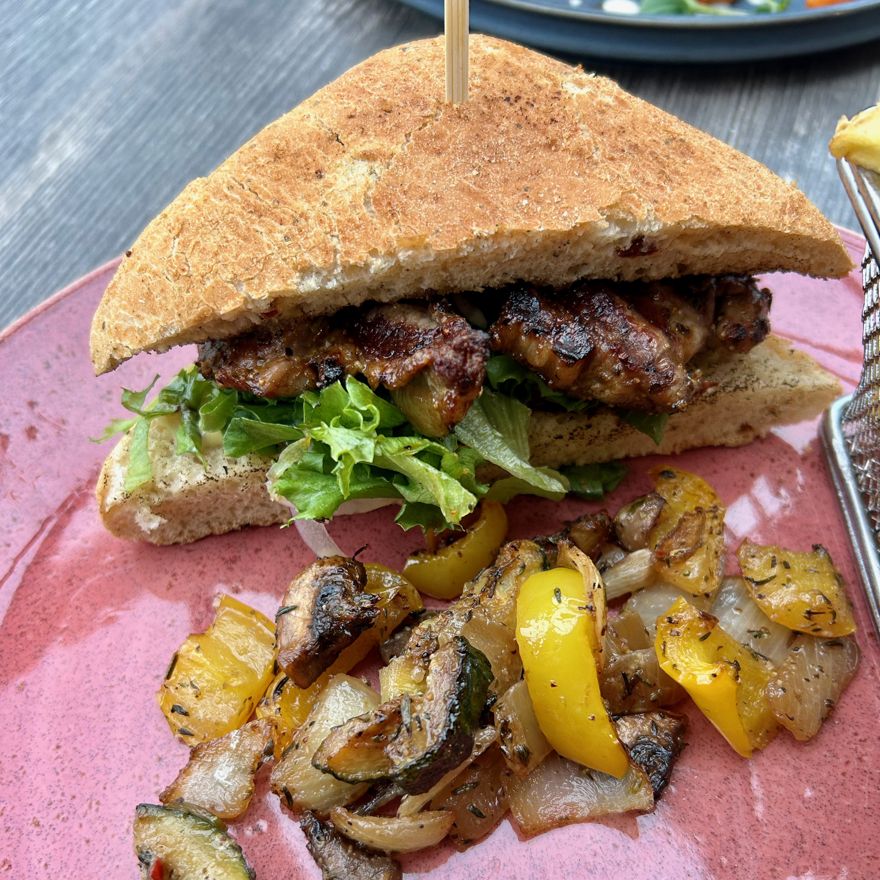
In this case, as we finished earlier, we had a late lunch at Systrakaffi upon arrival at Kirkjubæjarklaustur️.
- Local Arctic Char
- Steak sandwich
Total 8.550 ISK (≈ 60€) for 2 people.
💡 Tips: don’t be surprised by the price, it’s the normal price of the places.
Where to sleep?
The recommendation would be to sleep as close to Skaftafell as possible.
In our case, the closest accommodation we found was in Kirkjubæjarklaustur️. We preferred to stay “before” Skaftafell, than to drive a lot more road and get to Jökulsárlón and then have to go back and undo our way.
Keep discovering everything about Iceland:
- Day 0 in Iceland
- Day 1 in Iceland
- Day 2 in Iceland
- Day 3 in Iceland
- Day 4 in Iceland
- Day 5 in Iceland
- Day 6 in Iceland
- Frequently asked questions about Iceland
- Discover Iceland (movies & series)

Deja un comentario / Leave your comment